Traveling The Dixie Highway in Michigan
By Roger Reini (roger at rreini dot org)
This is an illustrated description of a southbound trip down the famous
Dixie Highway, the eastern branch of which went from Sault Ste. Marie
down to Florida.
Sault Ste. Marie to Birch Run
I haven't made that drive yet.
Birch Run to Clarkston
I've driven it but not photographed it yet.
Clarkston to Detroit
Pictures taken February 6, 2005
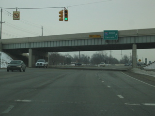

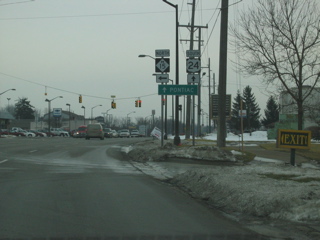

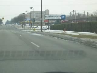
As the Dixie Highway passes underneath I-75 in Clarkston, it picks up a
number: US 24. It will continue as US 24 until the intersection
with Telegraph Road 8 miles to the southeast. The road passes
through a light-density suburban area. 2 or 3 miles to the
southeast is the intersection with M-15, which was the Dixie Highway's
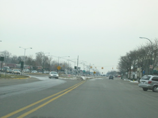
Flint Bypass Loop. Next come several miles of typical suburban
strip mall development in Waterford Township, along with occasional
glimpses of some lakes.

The intersection with Telegraph Road lies some 3 miles northwest of
downtown Pontiac. If you were to turn right (south) on Telegraph,
you would bypass downtown Detroit as you went through the northwestern
suburbs, the northwestern part of Detroit, western and downriver Wayne
County and Monroe, where you could take M-125 and connect back up with
the Dixie Highway. Or if you continued on US-24, it would
eventually become the Dixie Highway in Toledo. Ohio.


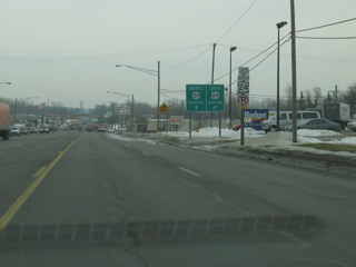
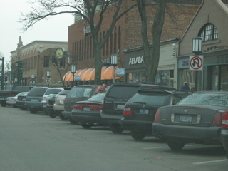
Past Telegraph, Dixie Highway (now Business US-24) becomes Oakland
Avenue as it enters Pontiac. About a mile down the road, Business
24 veers to the right and becomes Cass Avenue, one-way heading
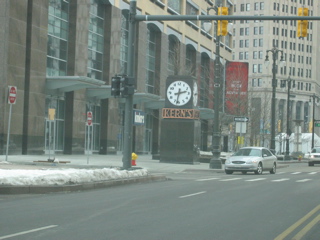
southeast. It eventually connects with Woodward Avenue and passes
on the west side of downtown Pontiac. Note: the original
Dixie Highway was Saginaw Street downtown. However, Saginaw is no
longer a through street, as it no longer connects with Woodward south
of town. The Phoenix Center (lower right picture above) is built
on top of the old highway.

South of downtown, the northbound and southbound sides of Woodward
reunite. It passes by a GM plant at South Boulevard. At
Square Lake Road, Woodward picks up the designation M-1, and it will
carry this all the way to downtown Detroit. It will be a divided
highway all the way to 8 Mile.


South of Big Beaver/Quarton, Old Woodward veers off to the right from
Woodward, which bypasses downtown Birmingham. Follow Old Woodward
through downtown Birmingham and see the upscale dining and shopping
establishments. This continues for about a mile and a half before
Old Woodward rejoins Woodward.
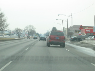

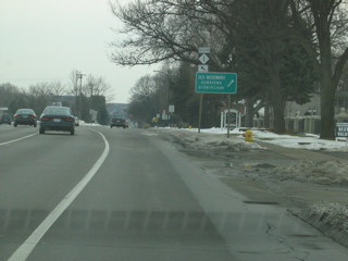
This portion of Woodward is typical strip-mall suburbia. It's
also the site of the annual Woodward Dream Cruise. At 12 Mile is
the Shrine of the Little Flower, once the home church of Father Charles
Coughlin, controversial priest and broadcaster of the 1930's.
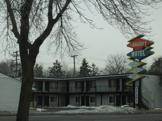


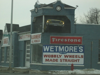
There are a number of older buildings along Woodward in this part of
the county. One of them, the Vinsetta Garage, almost looks
like it could have been there when this was still officially the Dixie
Highway. Woodward passes through Royal Oak, Huntington Woods and
fashionable Ferndale before crossing 8 Mile and entering the city of
Detroit.

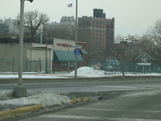
The trip through Detroit and Highland Park is not particularly scenic,
although the area around the Model T Plaza shopping center would not
have been out of place in the suburbs. Just south of that,
though, was a very rundown shopping area; one of the buildings still
had a marquee for Highland Appliance, the appliance and consumer
electronics chain that folded over a decade ago. And I passed a
library building in Highland Park that was boarded up. But there
are also signs of new housing in Detroit, which bodes well for the
future. Woodward passes through the New Center and Cultural
Center areas before
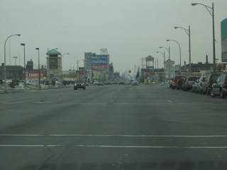
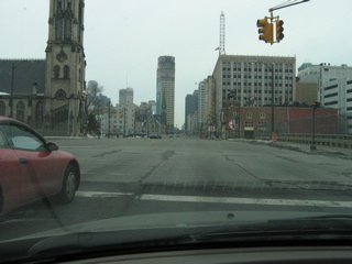
entering downtown. North downtown is home to the Fox and State
theaters, Comerica Park and Ford Field, and the Hockeytown Cafe.
Central downtown is still rather non-descript and lacking in
amenities. Woodward jogs a bit to avoid the new developments in
the Campus Martius area (the Compuware building, with a Borders book
store and a Hard Rock Cafe). At Fort Street, the Dixie Highway
turns right (note: Fort Street is closed for construction at Woodward
at this writing, so take Woodward down to Congress, turn right, and
then turn left to get onto Fort).
Detroit to Monroe
Pictures taken January 17, 2005


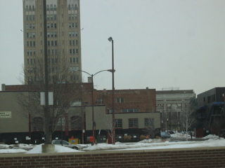
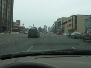
The Dixie Highway follows Fort Street out of downtown Detroit.
This is not a particular scenic part of town, although it does have the
grand Fort Street Presbyterian Church, visible in the right-hand
photo. The large concrete beam in the top part of the left-hand
picture is the track for the People Mover, a shuttle train that travels
in a loop around downtown Detroit.


The left-hand picture was taken near Fort Street and Rosa Parks
Boulevard, not far from the main post office. Here, you can see
the Detroit River and the shoreline of Windsor, Ontario. The main
highlight along this stretch is the
Ambassador Bridge connecting Detroit and Windsor. Fort
Street passes underneath the bridge. You can see part of the
bridge in the right-hand picture. To the right is an old facility
used by Greyhound Bus Lines.


After traveling 2 miles on Fort, turn left onto Clark Street to follow
the original Dixie Highway route. If you continued on Fort, you
would be following a later routing of US 25. Here, we'll be
following the original route. At the foot of Clark Street is one
of the former Boblo Island docks.


Now Clark Street immediately ends,
and you turn right onto West Jefferson, which we'll be following for
several miles. This stretch of Jefferson is heavily
industrialized. One highlight along the way is historic Fort
Wayne.


Continuing on Jefferson, you pass through the Downriver communities of
River Rouge, Ecorse, Wyandotte (Jefferson is called Biddle in
Wyandotte), Riverview, Trenton and Gibraltar. The upper-left
picture shows the drawbridge over the Rouge River; on the other side of
the bridge is the city of River Rouge. The upper-right picture
shows Jefferson as it goes through Ecorse. The bottom two
pictures show Wyandotte, which has a
nice riverside park where you can watch the freighters and other
vessels sail up and down the Detroit River. There's even a totem
pole at the corner of Jefferson/Biddle and Eureka.
South of Wyandotte,
you'll encounter two bridges leading to Grosse Ile. The northern
one is a privately-owned toll bridge, while the southern one is a
county-owned free bridge.


The road becomes progressively more rural as you leave the Downriver
communities. At the intersection of Jefferson and Huron River
Drive (just south of Lake Erie Metropark), turn right onto Huron River
Drive (not to be confused with South Huron River Drive, which is a few
miles farther south) and travel to the town of Rockwood. Turn
left onto Old Fort Road, which becomes Dixie Highway south of town.


The upper-left picture shows an old barn between Rockwood and
Monroe. Still visible is the painted sign for Mail Pouch chewing
tobacco. Many such signs have been restored around the country,
but not this one. The upper-right picture, taken south of the
barn on Dixie, shows a more-modern artifact of civilization: steam
rising from the cooling towers of the Fermi II nuclear power plant.
Follow this road until you encounter a road crossing
diagonally (shown in the bottom picture above). This is US
Turnpike to the left (the continuation of
Jefferson) and Dixie Highway to the right. Turn right, staying on
Dixie Highway.
Along this stretch of highway, you'll pass by the Fermi II plant.
You'll also pass by several small lakeside
communities as you drive into Monroe.


As you near Monroe and
cross I-75, you will see the typical businesses of freeway
intersections: gas stations, truck stops, motels/hotels, and
restaurants. X miles west of I-75, there is a Veteran's Memorial
Park, which has two helicopters on exhibit. Passing underneath
the John Dingell railroad bridge (named for the longtime Congressman
who represented the area -- and still represents it as of 2005), you
bear left and head towards Elm Street, on the north side of the Raisin
River. Turn right on Elm and proceed for one mile to M-125.
Along the way, you'll notice an apartment/condo complex on Kaye Lani
Street. This has been named for former Miss America Kaye Lani
Raye Rafko, who was from Monroe.
Monroe to Toledo
Pictures taken January 8, 2005


Turn left onto M-125, a.k.a. South Monroe Street, and cross over the
Raisin River into downtown Monroe. As you turn,
you'll see a large statue of General Custer astride his horse (Custer
was from Monroe).
Later, on your left will be an old Standard service station.


Continue to follow M-125 (Dixie) out of Monroe and to the
southwest. The road passes uneventfully through farmland as it
heads towards the Ohio state line. During the wintertime, you can
see snowmobile tracks in the snow on the farmers' fields.
Route information taken from "Dixie Highway East",
http://www.us-highways.com/dixiehwye.htm.
On to Ohio (coming soon)
Back to www.rreini.org
©2005 R. W. Reini